

- Is there an operational metro in Hanoi right now?
- Tickets, pricing, and how to pay like a local
- The last mile: Station to sight connectivity
- Is the metro your best choice? 3 common tourist scenarios
- Insider tips for a smooth and accessible ride
- How many metro lines are planned in Hanoi?
- Hanoi vs Ho Chi Minh City metro
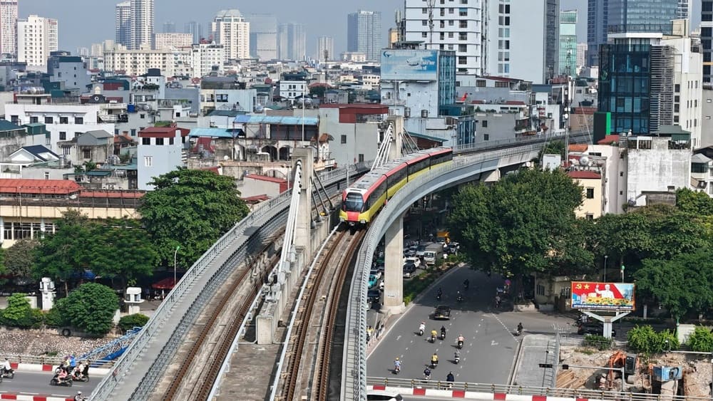
Is there an operational metro in Hanoi right now?
Yes, Hanoi currently operates two metro lines: Line 2A (Cat Linh-Ha Dong) and the newly inaugurated elevated section of Line 3 (Nhon-Cau Giay). This system provides a fast, reliable, and air-conditioned alternative to navigating the capital city's heavy street-level traffic congestion during your visit.
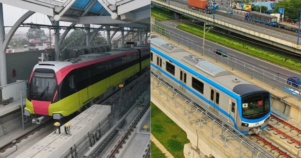
Line 2A: Cat Linh to Ha Dong
Spanning exactly 13.05 kilometers, this route passes through 12 elevated stations linking the central Dong Da district to the southwestern Ha Dong district. Your full route travel time will be approximately 23 minutes, a massive reduction compared to navigating street traffic on the congested Nguyen Trai artery. Trains operate daily from 5:30 AM to 10:00 PM, running strictly every 6 minutes during peak hours and every 10 minutes off-peak.
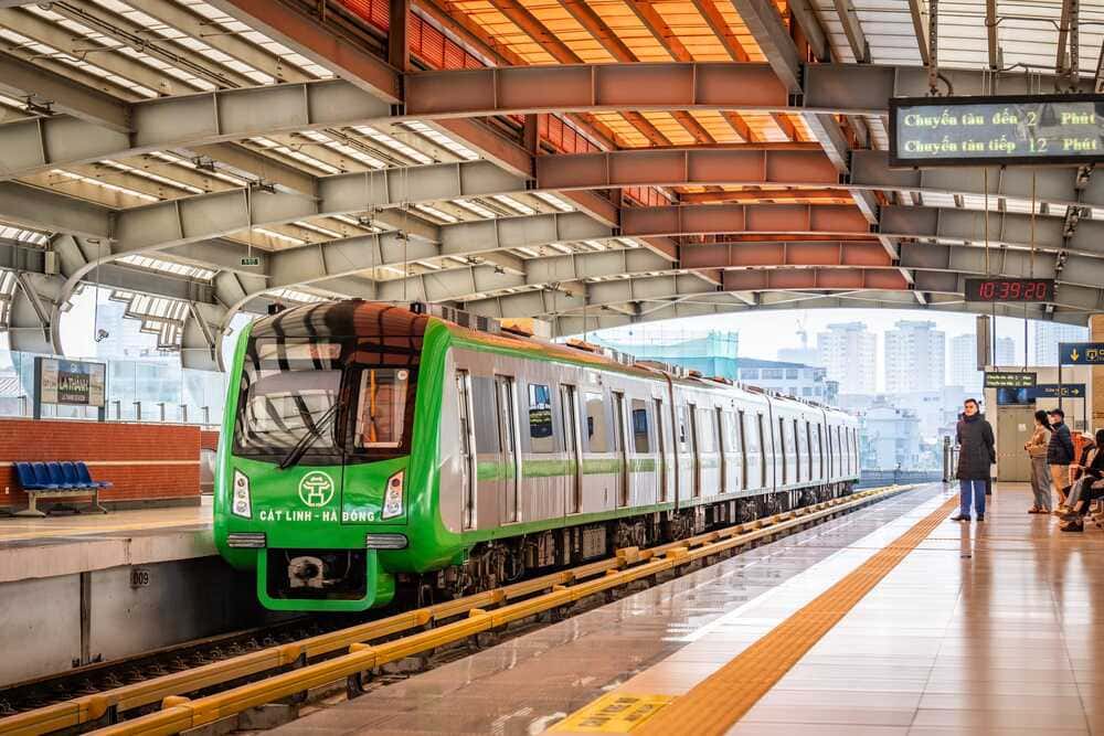
The stations feature prominent green signage and offer spacious platforms protected from severe monsoon rains. You will notice clear directional maps printed in both Vietnamese and English above the boarding gates, alongside digital monitors displaying exact arrival countdowns. Escalators and wide staircases lead directly from the main roads, dropping you safely above the motorcycle smog. Automated announcements broadcast in dual languages to ensure you never miss your designated exit.
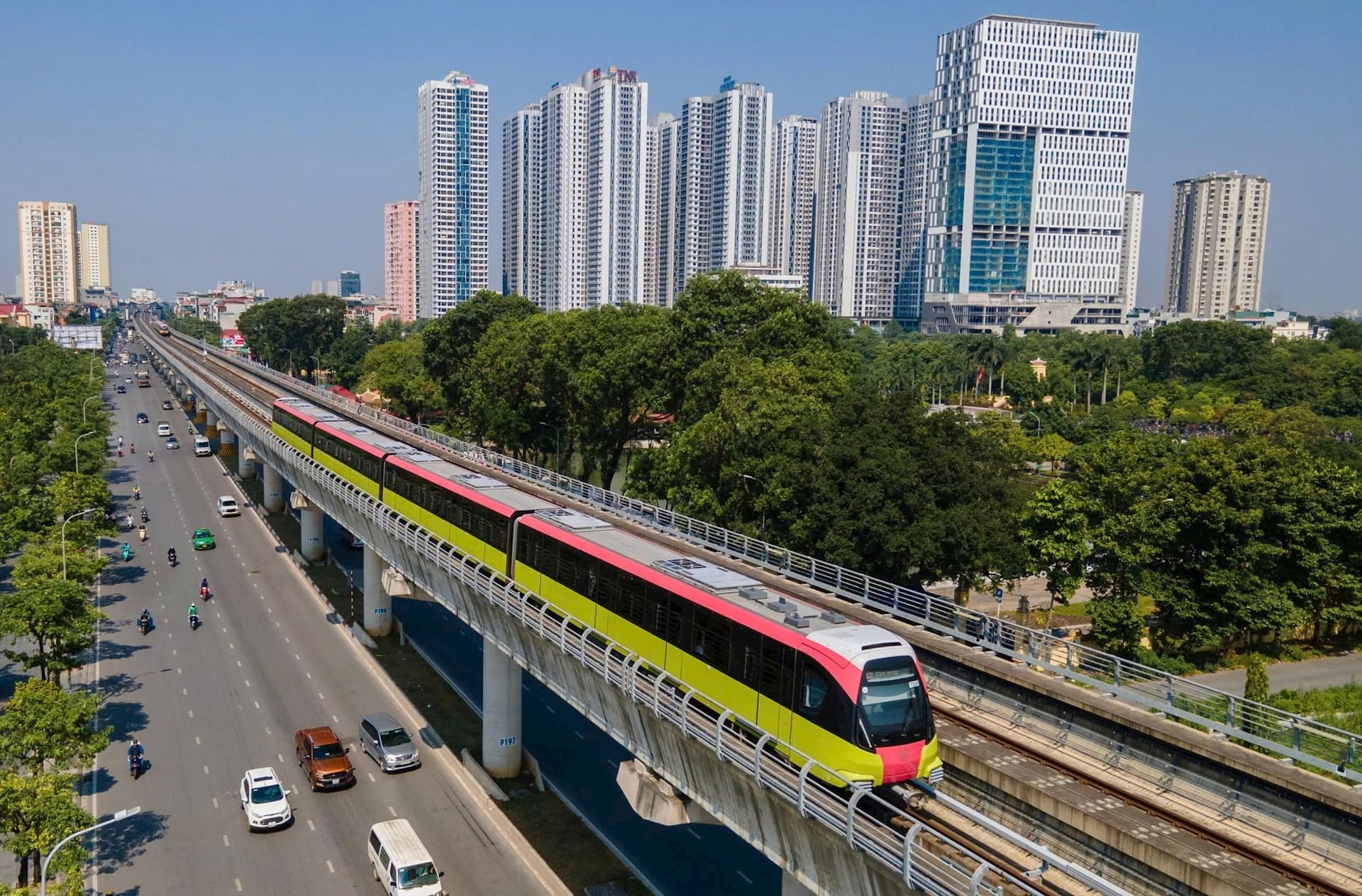
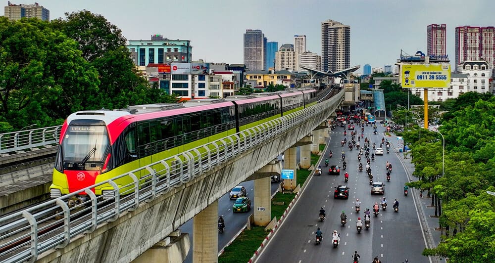
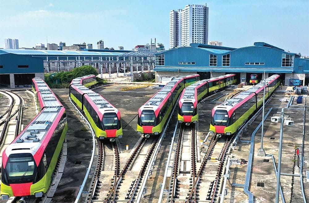
Line 3: Nhon to Cau Giay (Elevated section)
Officially inaugurated in November 2024, this elevated stretch represents the newest addition to the capital transit network. It connects the western suburbs directly to more central districts, terminating at the major Cau Giay transit hub. Planners estimate this corridor currently serves up to 90 million passengers annually, drastically cutting commute times for students and office workers heading downtown.
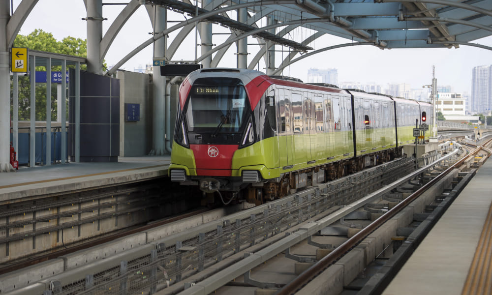
The architecture of Line 3 stations sports a distinct yellow color scheme and features expanded waiting halls to accommodate massive student populations. You will find platform edge doors installed for maximum safety, preventing passengers from accessing the tracks. Consequently, boarding procedures feel highly organized even during the heaviest periods of commuter traffic.
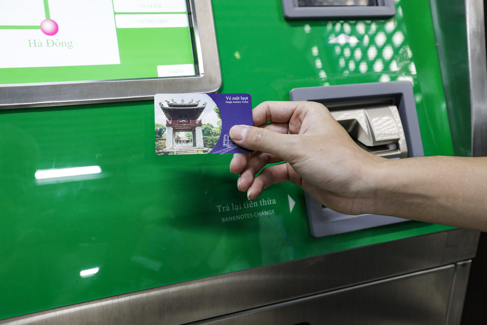
Tickets, pricing, and how to pay like a local
You purchase single-journey tokens, day passes, or monthly cards directly at station counters or automated machines. Fares remain heavily subsidized by the municipal government to encourage public transit adoption, making the train network one of the absolute cheapest ways to traverse the Vietnamese capital.
| Criteria | Line 2A (Cat Linh - Ha Dong) | Line 3 (Nhon - Cau Giay) |
|---|---|---|
| Single Ticket Cost | 8,000 - 15,000 VND (distance-based) | 8,000 - 12,000 VND (distance-based) |
| Day Pass Cost | 24,000 - 30,000 VND (unlimited 24h) | 24,000 - 30,000 VND (unlimited 24h) |
| Monthly Pass Cost | 200,000 VND (standard adult) | 200,000 VND (standard adult) |
Single ticket fares range from 8,000 to 15,000 VND, depending entirely on your total travel distance. You receive a durable plastic token which you tap on the entry gate sensor and insert into the exit gate slot upon arrival. If you plan to explore multiple stops, bypass the token system entirely and buy the physical Day Pass. Costing just 24,000 to 30,000 VND, this card allows you unlimited travel for a strict 24-hour period from the moment of your very first tap.
For long-term travelers or expats, the monthly pass at 200,000 VND provides unmatched economic value. You must provide a passport-sized photo at the ticket counter to register for this personalized card. This option saves both money and the daily hassle of queuing at automated ticket machines during the chaotic evening rush.
📌 Good to know:
Skip the ticket machines and the 'The ve giao thong HN' mobile app, which requires a registered Vietnamese phone number. Tourists can simply tap a contactless Mastercard directly at the gate for seamless entry! Seniors 60+ also travel entirely for free by showing official ID or a passport at the manual counter.
The last mile: Station to sight connectivity
Reaching key historical landmarks often requires combining a train ride with a short walk or a localized ride-hailing service. Since the current tracks do not penetrate the immediate historic core, you must plan your final transit leg carefully to maximize your daily itinerary efficiency.
Cat Linh station to the Temple of Literature
Navigating from the terminal stop to this 11th-century university requires a specific transit plan. On foot, the direct distance measures exactly 1.2 kilometers, taking an average adult approximately 15 minutes. The route follows Ton Duc Thang street, which offers relatively straightforward navigation but demands crossing several high-volume traffic intersections. Sidewalks in this district often function as motorbike parking lots, pushing pedestrians directly onto the roadway edges.
To avoid the midday heat or heavy seasonal rain, you should book a localized ride-hailing service. A 5-minute Grab or Xanh SM bike ride costs between 15,000 and 25,000 VND. You will find dozens of drivers waiting directly at the bottom of the Cat Linh station escalators. Requesting a car or bike via the mobile app ensures you secure exact pricing without needing to haggle with unmetered taxi operators.

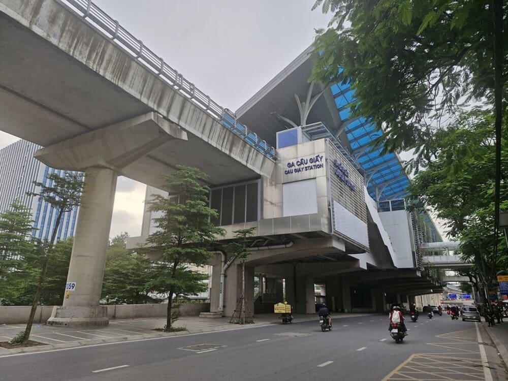
Cau Giay station to Thu Le park
Exiting at the Cau Giay terminus drops you immediately adjacent to one of the largest public green spaces in the western districts. A short, three-minute walk connects the Line 3 station stairwell directly to the main entrance gates of Hanoi's central park and zoo area. The pedestrian infrastructure here is newly paved, well-maintained, and heavily shaded by mature street trees.
This direct access allows families to bypass the notoriously congested traffic jams around the Kim Ma intersection entirely. You simply scan out of the turnstiles, descend the right-side escalator, and cross a single, light-controlled pedestrian walkway to reach the ticket booths for Thu Le Park.
Is the metro your best choice? 3 common tourist scenarios
The utility of the urban railway depends entirely on your specific destination and the time of day you choose to travel. Certain transit routes offer immense time savings, while others will leave you stranded far from major tourist corridors and historic sites.
| Criteria | Metro (Line 2A/3) | Grab / Taxi | Walking |
|---|---|---|---|
| Average Time | 23 - 25 mins (full line) | 45 - 60 mins (peak hours) | N/A for cross-district routes |
| Cost | 8,000 - 30,000 VND | 50,000 - 150,000 VND+ | Free |
| Pros/Cons | Pro: Beats traffic / Con: Limited coverage | Pro: Door-to-door / Con: Gridlock delays | Pro: Maximum freedom / Con: Heat, bad sidewalks |
Scenario 1: Visiting the Old Quarter
Your verdict here is simple: skip the metro entirely. The current elevated trains do not enter the historic Old Quarter boundaries. The absolute closest stop, Cat Linh station, remains over 3 kilometers away from Hoan Kiem Lake. Walking this specific distance takes nearly an hour through highly congested commercial zones like Dien Bien Phu street. Walking or utilizing a ride-hailing app directly from your hotel remains far more efficient here.
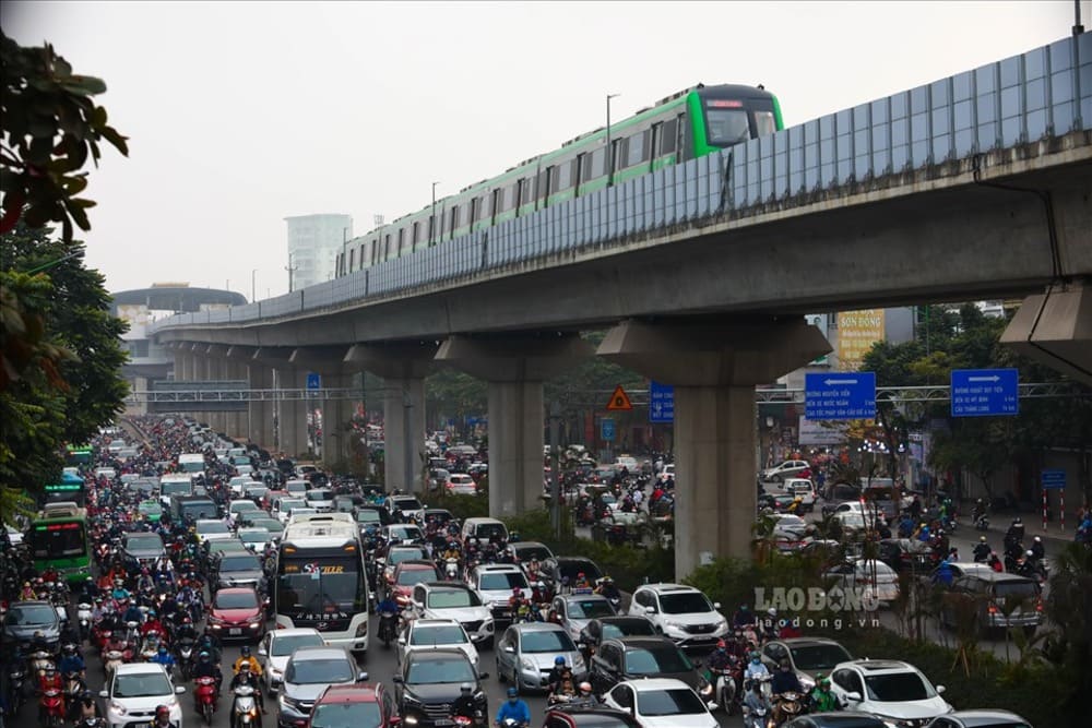
Scenario 2: Rush hour transit (4:30 PM - 6:30 PM)
Your verdict: definitely take the metro. Between 4:30 PM and 6:30 PM, major surface arteries like Nguyen Trai, Tay Son, and Xuan Thuy suffer from severe, unmoving gridlock. A standard car journey spanning these specific districts easily consumes an hour of your evening. By choosing the elevated railway, that unpredictable 1-hour gridlocked car journey becomes a highly reliable, stress-free 25-minute train ride.
Scenario 3: Low-budget sightseeing day
Your verdict: this represents excellent value. Buy a Day Pass to hop freely between Cat Linh, Cau Giay, and various intermediate neighborhood stops for a fraction of the cost of multiple Grab rides. It allows you to explore residential districts, local wet markets, and authentic cafes that transient tourists rarely see, all while maintaining strict control over your daily travel budget.
Insider tips for a smooth and accessible ride
Maximizing your transit experience requires understanding local etiquette, identifying the best carriage positions, and utilizing the robust accessibility features installed at every stop. Following these unwritten rules ensures you travel efficiently alongside local Vietnamese commuters.
For the best views, sit directly on the right side of the train when traveling south on Line 2A from Cat Linh toward Ha Dong. This specific orientation provides optimal elevated views of the dense cityscape and large urban lakes. The expansive carriage windows remain tinted to reduce severe sun glare, allowing you to observe the sprawling urban density in complete air-conditioned comfort.
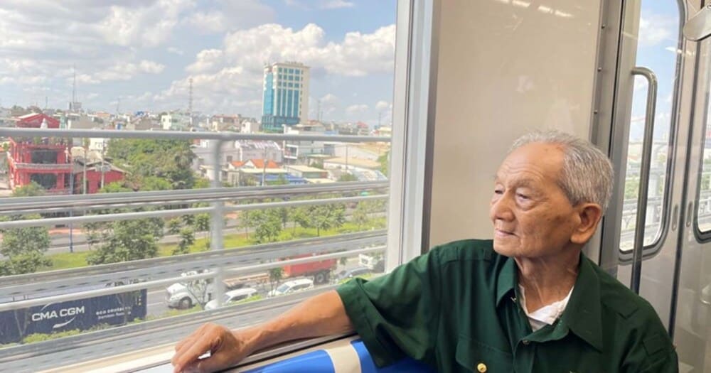
The system is heavily equipped for travelers with disabilities. Every station features ground-to-platform priority elevators, wide automated ticket gates designed for wheelchairs, and designated priority seating near the carriage doors. Tactile paving successfully guides visually impaired passengers from the street level directly to the boarding zone, ensuring safe and independent travel.
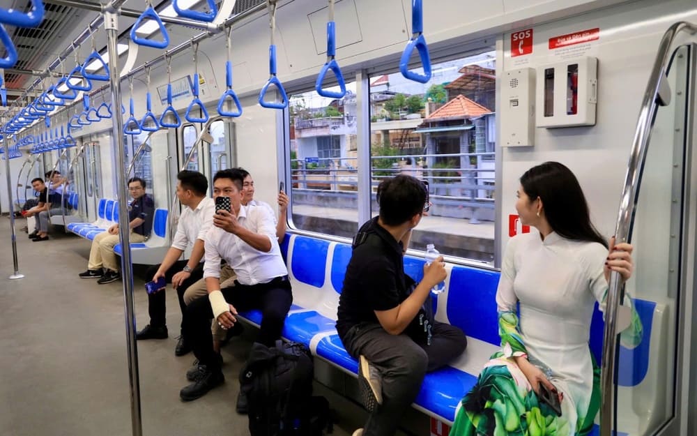
You must also observe strict local etiquette while onboard. Avoid using flash photography inside the carriages, as sudden bright reflections on the glass can severely distract the train driver during night operations. Furthermore, eating, drinking, and smoking are strictly prohibited past the ticket barriers. Always stand on the right side of the escalators to allow hurried commuters to walk freely on the left.
How many metro lines are planned in Hanoi?
Hanoi plans to build 14 metro lines totaling 550 kilometers by 2030, fundamentally transforming the capital into a transit-oriented metropolis. Key upcoming infrastructure projects include the $1.3 billion Line 2 segment through the historic core, opening around 2029, and Line 5 from Van Cao to Hoa Lac starting in 2026.
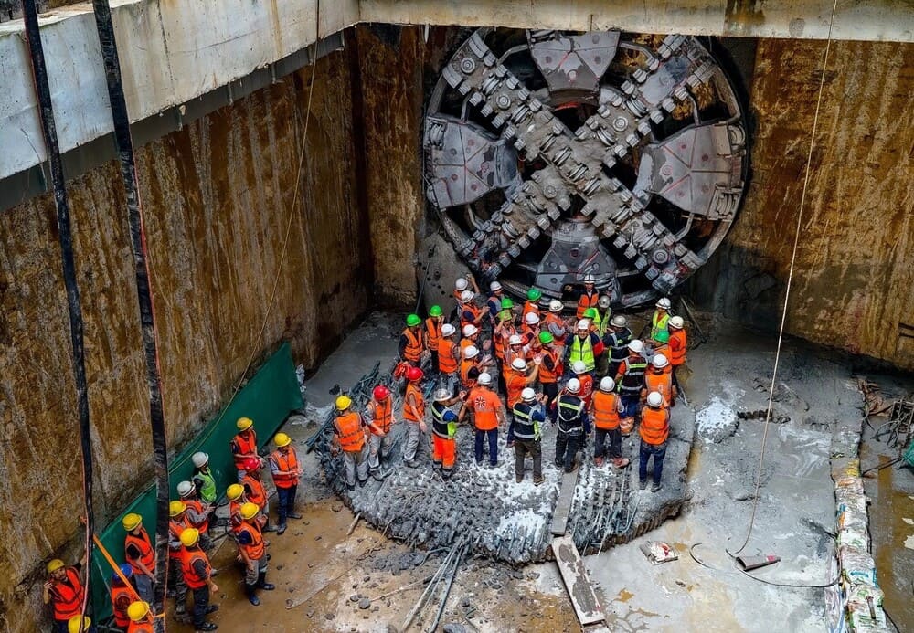
Line 2: Tunneling through the historic core
This massive infrastructure project represents the most complex civil engineering challenge in the city's history. Groundbreaking segments feature deep underground tunneling beneath narrow heritage streets, eventually transitioning to elevated guideways in the northern suburbs. Construction teams face immense logistical hurdles, particularly regarding the preservation of structural integrity around century-old French colonial buildings and ancient pagodas.
Public debates currently surround the exact placement of underground stations, as engineers attempt to minimize vibrations near historical monuments. Once completed, this route will eventually connect traditional, densely packed neighborhoods with modern transit-oriented development. You will be able to travel from the airport highway directly into the old city center without touching a road vehicle.
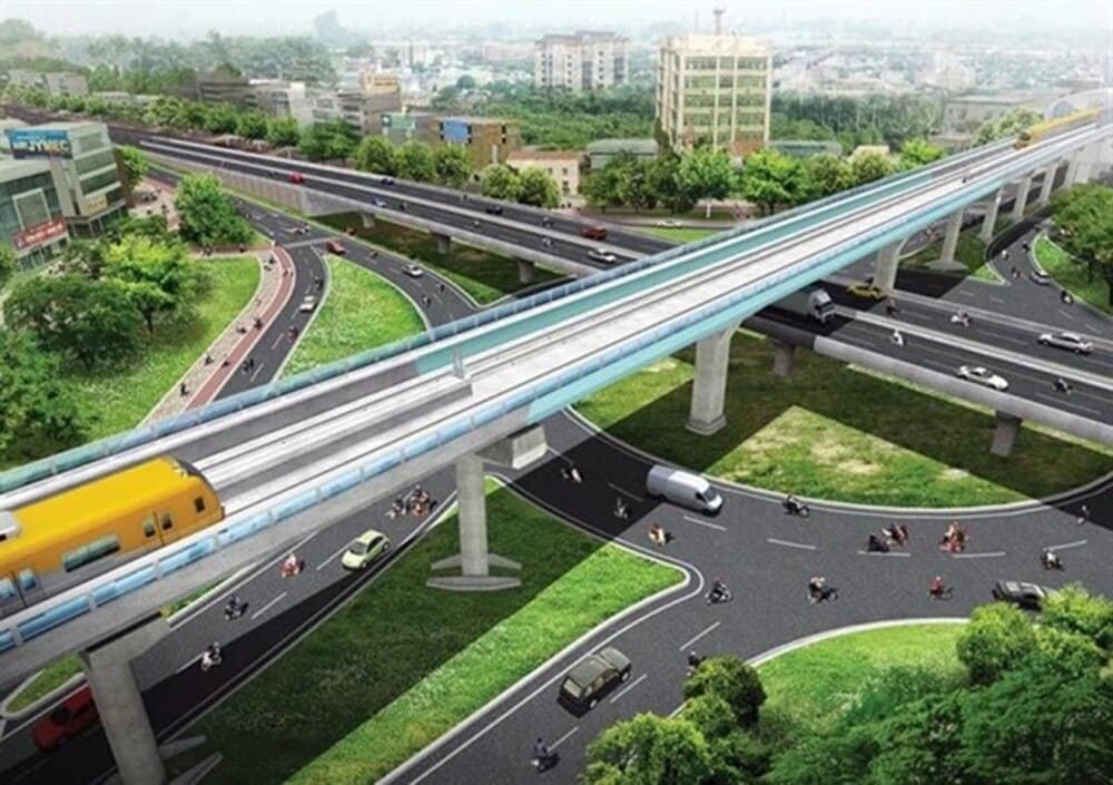
Line 5: Van Cao to Hoa Lac
Measuring an impressive 39.6 kilometers, this high-speed commuter rail will officially begin active construction in 2026. Planners have slated commercial operations to launch by 2030, setting an incredibly aggressive timeline for completion. The track layout utilizes the exceptionally wide median strips of the Thang Long Avenue expressway, allowing for faster operational speeds and significantly fewer property acquisition delays.
This specific project proves crucial for connecting the administrative city center directly to the western Hoa Lac satellite city. The terminus will serve the newly established national university campuses and advanced high-tech manufacturing parks. Once operational, you can commute from downtown out to these technological suburbs in under 45 minutes, fundamentally reshaping residential patterns in the capital.
Hanoi vs Ho Chi Minh City metro
While both major Vietnamese cities are heavily investing in urban rail, Hanoi currently operates a significantly more advanced active network than Ho Chi Minh City. Bureaucratic delays, safety audits, and funding negotiations have caused vastly differing timelines for these national mega-projects.
📌 Good to know:
When comparing regional transit, Hanoi is currently leading Vietnam's urban railway development with two fully operational lines, while Ho Chi Minh City's much-anticipated Line 1 is still actively working toward its full commercial launch following years of testing.
The northern capital benefits from decisive administrative action regarding its operational corridors. By successfully launching both the Cat Linh and Cau Giay elevated tracks, local residents have already integrated train travel into their daily routines. Conversely, southern commuters continue relying exclusively on city buses and private motorbikes while awaiting final safety certifications for the Ben Thanh to Suoi Tien track.
Both systems utilize entirely different international contractors and funding models, leading to distinct architectural styles, rolling stock designs, and ticketing technologies. Consequently, the ticketing platforms are currently incompatible. You cannot use a physical transit card purchased in Hanoi for future travel in Ho Chi Minh City. Each municipality retains independent control over fare structures, operating schedules, and long-term network integration strategies.

✨ Discover more of our thoughtfully crafted blog articles:
- Temple of Literature: History, tickets, and self-guided tour 2026
- Top things to do in Hanoi: Itineraries, costs, and insider tips
- Hanoi Old Quarter guide: Itineraries, budgets, and survival tips
- Coffee in Vietnam: Culture, History, Types & How to Drink It Like a Local
- One Day in Hanoi Itinerary: Master the Chaos